Latest Topics in News

Tamil Nadu Map: Districts, Geography & Boundaries
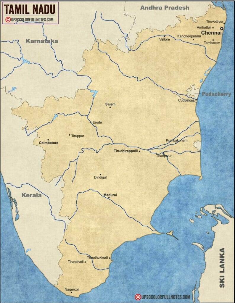
Tamil Nadu is a coastal state in southern India shown on the country map covering 130,058 km² with 38 districts and a 1,076 km Bay of Bengal coastline — the second-longest of any Indian state, capital Chennai.
What does the Tamil Nadu map show?
The Tamil Nadu map shows the state’s 38 districts, 1,076 km Bay of Bengal coastline, two mountain ranges (Western and Eastern Ghats), and four major rivers — Cauvery, Vaigai, Tamraparani, and Palar — across the southeastern Indian peninsula.
How many districts are in Tamil Nadu in 2026?
Tamil Nadu has 38 districts as of 2026. The number rose from 32 to 38 during the 2019–2020 reorganization, when seven new districts were created. Older maps showing 32 or 33 districts are out of date.
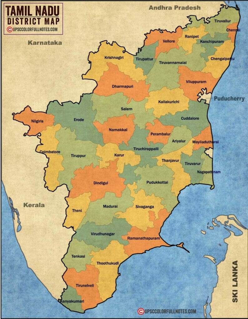
Northern districts
Chennai, Tiruvallur, Kanchipuram, Chengalpattu, Vellore, Tirupathur, Ranipet, Krishnagiri.
Western districts
Coimbatore, Tiruppur, Erode, Salem, Namakkal, Dharmapuri, Karur, The Nilgiris.
Central districts
Tiruchirappalli, Thanjavur, Tiruvarur, Nagapattinam, Mayiladuthurai, Ariyalur, Perambalur, Cuddalore.
Southern districts
Madurai, Theni, Dindigul, Sivagangai, Ramanathapuram, Virudhunagar, Tirunelveli, Tenkasi.
Coastal and far-south districts
Thoothukudi, Kanyakumari, Pudukkottai, Kallakurichi, Villupuram, Tiruvannamalai.
Which is the 34th district of Tamil Nadu?
The 34th district of Tamil Nadu is Mayiladuthurai, created on 28 December 2020 after being bifurcated from Nagapattinam district. Mayiladuthurai comprises four taluks: Kuthalam, Mayiladuthurai, Sirkazhi, and Tharangambadi.
What are the borders of Tamil Nadu?
Tamil Nadu shares borders with three Indian states and one union territory: Andhra Pradesh and Karnataka to the north, Kerala to the west, and Puducherry on the east coast. The Bay of Bengal forms the eastern border, and the Indian Ocean lies to the south.
Does Tamil Nadu border Sri Lanka?
No, Tamil Nadu does not share a land border with Sri Lanka. The two are separated by the Palk Strait, a narrow sea channel only 30 km wide at its closest point near Rameswaram.
What physical features appear on the Tamil Nadu map?
The Tamil Nadu map’s physical features include the Western Ghats, Eastern Ghats, Coromandel Coast, and four river basins organized in the table below.
| Feature | Detail |
|---|---|
| Western Ghats (TN section) | Anaimalai, Nilgiri, Palani, Cardamom hills — UNESCO World Heritage; biodiversity hotspot |
| Eastern Ghats (TN section) | Javadi, Shevaroy, Kalrayan hills — lower elevation; mining belt |
| Coromandel Coast | 1,076 km along Bay of Bengal — second-longest state coastline in India |
| Cauvery basin | Largest TN river basin; inter-state water dispute |
| Vaigai basin | Madurai region; Pandya-era irrigation |
| Tamraparani basin | Tirunelveli region; ancient continuous irrigation |
| Palar basin | Northern TN; tannery and leather belt |
Is Tamil Nadu a coastal state?
Yes, Tamil Nadu is a coastal state with a 1,076 km coastline along the Bay of Bengal — the second-longest of any Indian state after Gujarat.
Which is the largest district in Tamil Nadu by area?
The largest district in Tamil Nadu by area is Dindigul at 6,289 km², located in the south-central part of the state and home to the Sirumalai and Palani hills.
Which is the smallest district in Tamil Nadu by area?
The smallest district in Tamil Nadu by area is Chennai at 462 km², the state capital and most densely populated district.
What are the major cities on the Tamil Nadu map?
The major cities marked on the Tamil Nadu map are the top 5 by population: Chennai, Coimbatore, Madurai, Tiruchirappalli, and Salem. Chennai dominates as both the state capital and largest city.
| City | Population (2011 Census) | Region |
|---|---|---|
| Chennai | 4,681,087 | Northern coast (capital) |
| Coimbatore | 1,061,447 | Western (Kongu Nadu) |
| Madurai | 1,016,885 | Southern |
| Tiruchirappalli | 846,915 | Central |
| Salem | 831,038 | Western |
Which is the largest city in Tamil Nadu?
The largest city in Tamil Nadu is Chennai with a population of 4.68 million (2011 Census), more than four times the population of the second-largest city, Coimbatore. Chennai is also the state capital and a major IT, automotive, and port hub.
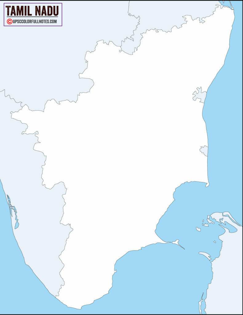
Need a blank Tamil Nadu outline for tracing?
The Tamil Nadu outline map shows the state border without district divisions — useful for map-marking practice and labelling exercises.
Why does the Tamil Nadu map matter for UPSC?
The Tamil Nadu map appears in UPSC prelims and mains questions on coastline length, the 2019–2020 district reorganization, the Western Ghats UNESCO heritage zone, and inter-state river disputes. Tamil Nadu also hosts five national parks and the Gulf of Mannar Biosphere Reserve — see National Parks in Tamil Nadu with Map for full details on protected areas.
The Tamil Nadu map covers 130,058 km² of southeastern India with 38 districts, capital Chennai, and a 1,076 km Bay of Bengal coastline — the second-longest of any Indian state.