Latest Topics in News

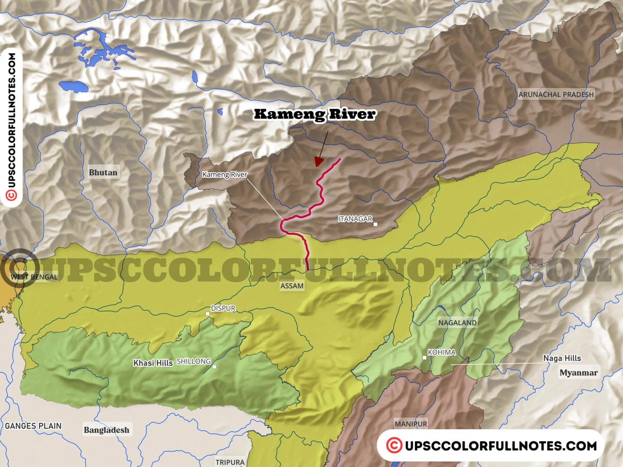


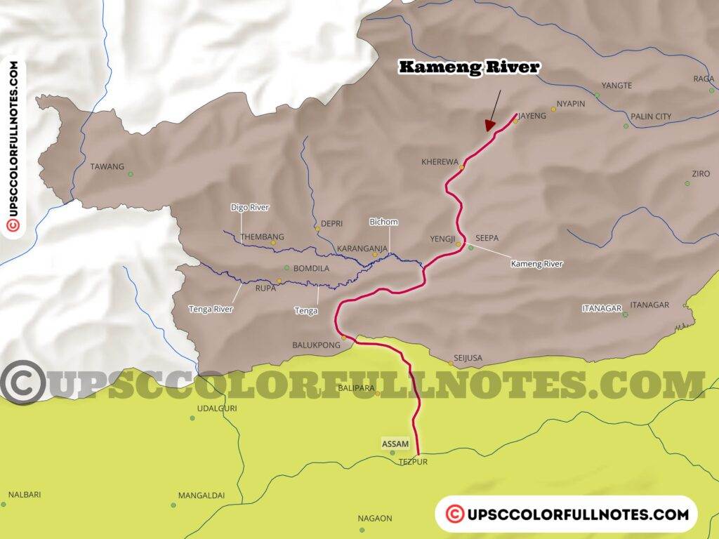
Kameng River
Origin and river course
The Kameng river originates from the snowfields of the Kangto massif and Gori Chen mountain ranges at an approximate elevation of 5,400m. The river traverses a total distance of approximately 242 km as it flows in a south and south-easterly direction through mountain, hill, and plain regions until reaching its confluence with the Brahmaputra river.
In this article, the UCN Team provides a detailed analysis, presenting key facts and insights on the Kameng River alongwith Kameng RIver Map.
The Kameng river basin covers an area of 11,280 sq km. Along its course, the Kameng river is joined by several tributaries including Digien, Tenga, Kahri Dikrai, Bor Dikrai etc. The multiple tributaries joining the Kameng River increase its overall discharge and drainage area.
Tributaries
As the Kameng River flows from its origin to its confluence with the Brahmaputra River, it is joined by several tributaries. The principal right bank tributaries of the Kameng River are the Bichom, Digien, Tenga, and Tipi rivers. The major left bank tributaries are the Pacha, Papu, Diju, Namiri, Upper Dikrai, Kahri Dikrai, and Bor Dikrai rivers.
One of the main tributaries is the Dirang Chu which joins the Kameng River along with another key tributary called the Tenga River. These two tributaries drain significant catchment areas that contribute substantial flows into the main Kameng River.
Catchment area
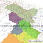
The Kameng River basin covers a total area of 11,280 sq km. Geographically, the Kameng river basin stretches across several districts and countries.
Within India, the basin covers areas in the West Kameng and East Kameng districts in Arunachal Pradesh as well as a significant part of the Sonitpur district in Assam. Internationally, a small part of Bhutan to the west and China to the north also falls within the Kameng river basin boundaries.
The Kameng river forms an important tributary of the Brahmaputra River, draining all the catchment areas mentioned above and discharging its waters into the Brahmaputra at Tezpur in Assam.
Climate
Seasons
The lower altitude areas of the Kameng River basin have four distinct seasons: winter (November to February), spring/pre-monsoon (March to May), summer/monsoon (June to September), and a short autumn (September-October).
In higher mountain elevations above 3,500m, there are longer and colder winters from October to April, followed by the rainy season from May to September.
Temperature variation by altitude
There are tropical, temperate, and alpine climate zones based on altitude. The foothills and lower valleys experience average temperatures around 24.5°C, while mid-altitude valleys average around 13°C.
Winter temperatures drop below 5°C in mid-altitudes and are below freezing in alpine elevations above 3,500m.
Precipitation patterns
Around 70% of rainfall in the Kameng River basin is brought by the summer monsoons. The remaining precipitation occurs due to winter western disturbances and storms from the Bay of Bengal.
Monsoonal rains
The summer monsoon lasts from June to September with heavy rainfall, averaging peak monthly rainfall around 425mm during monsoons.
Snowfall
Areas above 4,000m in elevation experience snowfall during winter months. However, due to winter disturbances, occasional snowfall can occur at lower elevations as low as 200m.
Geology
The Kameng River basin contains a wide spectrum of litho-stratigraphic units ranging from Pre-Cambrian crystallines in the north to Quaternary Alluvium in the south.
The Kameng River basin has a wide range of rock groups and sediment layers spanning great geological time. Upstream, ancient Pre-Cambrian crystalline basement rocks like granite and gneiss prevail. Downstream, the floodplains contain more recent Quaternary alluvium sediments.
Four main rock packages are found from north to south. The Siwalik zone along the Himalayan front consists of fault-bounded sandstones, siltstones and mudrocks. South of these hills lies the Gondwana group containing sandstones, shales and coal seams. Underthrust beneath the Siwaliks is a band of metamorphosed Lesser Himalayan rocks intruded by granite. All these groups have been uplifted and displaced by major thrust faults like the Main Boundary Thrust accommodating compression of the orogen. The southernmost zone flanking the Brahmaputra River is made up of loose Quaternary gravel, sands and silts lain down by Himalayan river systems.
Geomorphology
The landscape of the Kameng basin is sculpted from an interplay of tectonic forces and fluvial erosion. Upstream, folded and faulted bedrock strata form rugged, steep-sided structural hills flanking the Himalayan mountain front. Further downstream, the river has cut a broad piedmont zone of coalescing alluvial fans flanking the Sub-Himalaya.
As the Brahmaputra is approached, the confined Kameng River emerges from hills onto expansive floodplains where it switches into a braided, meandering plan. Scattered inselbergs project from these plains, remnants of ancient basement rocks. Across the fluvial lowlands, sand and gravel bars, swampy backwaters, oxbow lakes and terrace fragments record a complex history of Himalayan sediment load deposition and monsoonal flood dynamics.
Final Thoughts
The UCN team is under the impression that, the Kameng River is a major Himalayan tributary of the Brahmaputra River, draining a large mountainous catchment area spanning parts of Arunachal Pradesh and Assam. Originating from glacial sources in the eastern Himalayan ranges, the Kameng is fed by meltwater as well as monsoonal rainfall. The river has carved diverse geomorphic landscapes across its basin, from steep dissected structural hills flanking the mountain front to expansive alluvial plains closer to the Brahmaputra confluence near Tezpur.
Understanding the hydrology and geomorphology of rivers like the Kameng provides important insights into the pressures facing Himalayan catchments amid climate shifts and development projects. Quantifying discharge contributions from tributaries flowing south from the eastern Himalayas toward the Brahmaputra floodplains can help improve water resource planning across northeastern India.
FAQ
What major river does the Kameng River flow into?
The Kameng River is a key tributary that flows into the Brahmaputra River in Assam. It merges with the Brahmaputra at Tezpur, near the Kolia Bhomora Setu bridge.
Which glacial source does the Bichom River flow from?
The Bichom River originates from the Bichom Glacier in the Greater Himalaya ranges. It is an important tributary contribution to the overall Kameng River network.
What is another name for the Kameng in the Assam plains?
In Assam, the Kameng River is referred to as the Jia Bhorelli or Jia Bharali as it flows through the plains before meeting the Brahmaputra.
Which protected parks border the Kameng’s course?
The Pakhui Wildlife Sanctuary and Kaziranga National Park flank the passage of the Kameng through the Assam valley.
Where does the Kameng ultimately discharge its waters?
The Kameng transports meltwater and drainage from Arunachal Pradesh, meeting the mighty Brahmaputra River at Tezpur in the state of Assam after a course of 264 kilometers.