Latest Topics in News


Kopili River
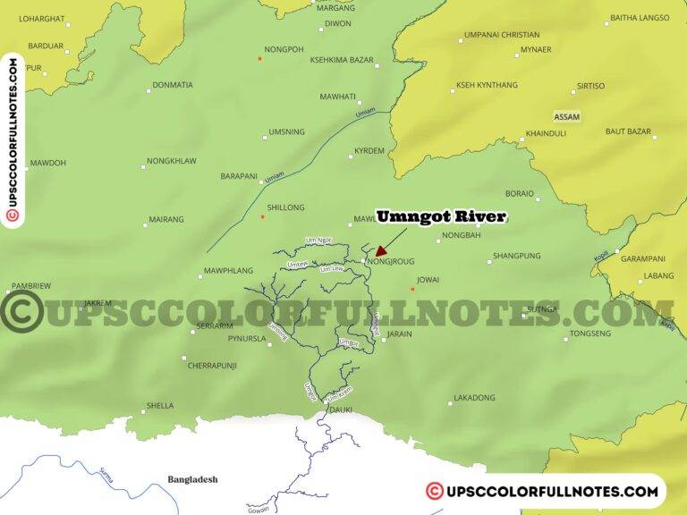
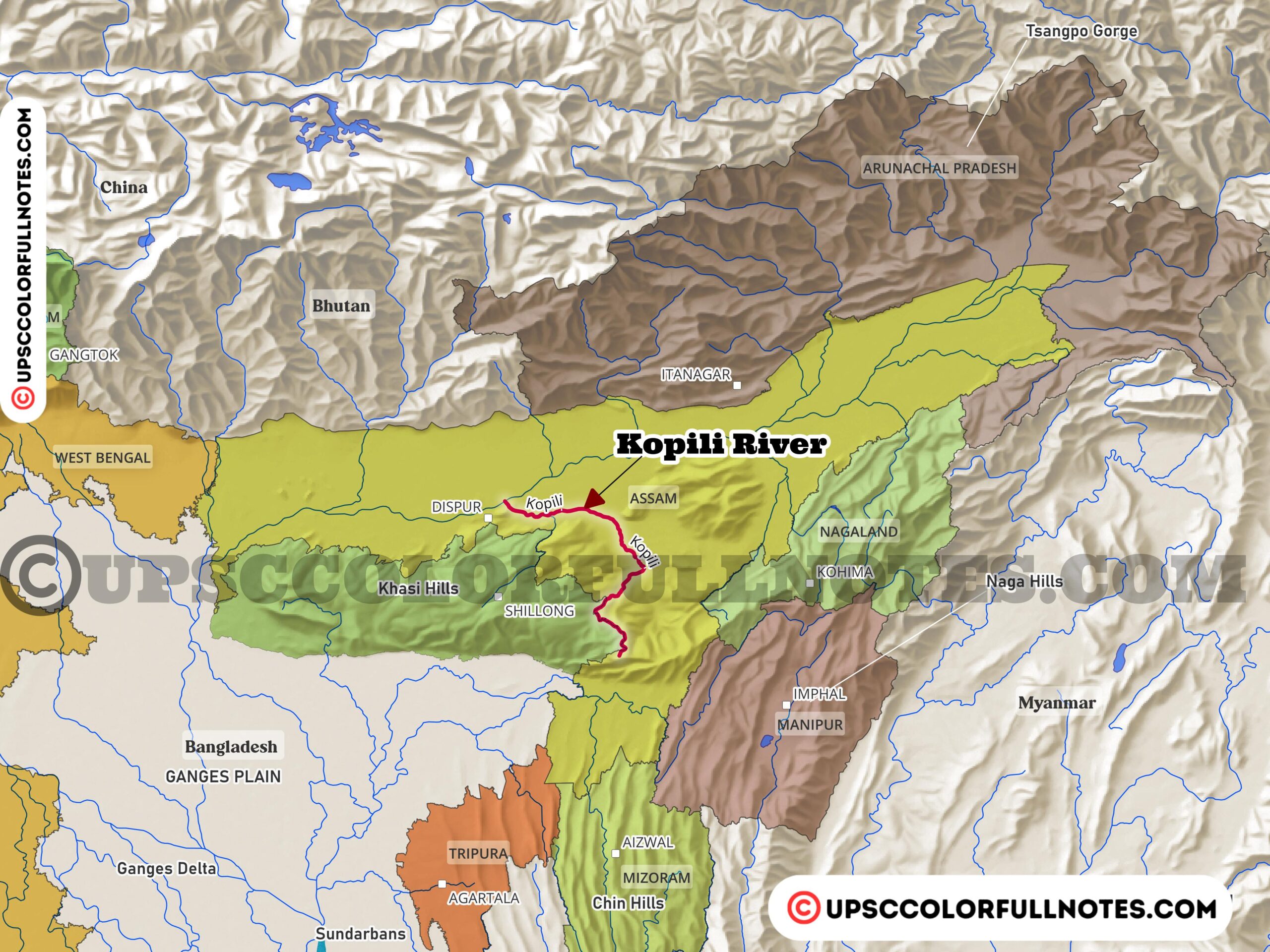
The Kopili River is a major left bank tributary of the Brahmaputra in Northeast India. It originates from the Saipong Reserve Forest in southeast Meghalaya.
Here, the UCN Team’s detailed analysis presents key information and insights related to Kopili River alongwith Kopili River Maps.
The 256 km long Kopili forms a common border between Meghalaya and Assam for 78 km. The remaining 178 km of the river flows through Assam before joining the Brahmaputra at Kopilimukh.
The Kopili has a total catchment area of 16,420 sq km. It is the largest south bank tributary of the Brahmaputra in Assam.
The river flows through the Meghalaya plateau, central Assam and the hill districts of Assam. Known for its rocky and swift nature, the Kopili features many waterfalls and supports rare wildlife.
The river has been harnessed for irrigation and power projects, including the Kopili Flow Irrigation Scheme and the Kopili Hydro Electric Project. It is an important geographical and ecological feature of Northeast India.
However, in recent years the Kopili has faced increasing pollution threats from unauthorized mining activities, domestic sewage, agricultural runoff, and soil erosion. This has led to issues like acidic pH and high sediment loads in the river. Proper management and conservation efforts are needed to restore the environmental integrity of this important Himalayan river system. The Kopili’s biodiversity and role in supporting local livelihoods make it a river basin worth protecting through sustainable development policies.
Origin and Course
The Kopili River originates from the south-western slopes of the Shillong Peak in the state of Meghalaya. It is an inter-state river that flows through the Indian states of Meghalaya and Assam.
The Kopili river basin extends across a geographical area of around 13,556 sq km. It is bounded by the Jayanti Hills to the west and the South Cachar and Mikir Hills to the east.
Some of the major tributaries of the Kopili in its upper reaches are Kharkor, Myntriang, Dinar, Longsom, Amring, Umrong, Longku and Langkri rivers.
In the lower stretches in Assam, the Kopili is joined by tributaries like Diyung, Jamuna, Umkhen-Borapani, Killing, Umtrew/Digaru and Kolong.
The total length of the Kopili River is around 290 km before it merges with the Brahmaputra River. The river has a catchment area of 16,420 sq km.
It flows in a southwest direction after originating from Meghalaya, traversing the Assam-Meghalaya border before entering the plains of Assam. The Kopili finally joins the Brahmaputra at a place known as Kopilimukh.
The Kopili River flows past several major towns and cities as it traverses through the two states of Meghalaya and Assam. Some of the key urban centers located along the course of the river include Resubelpara, Jowai, Umrangso and Kampur.
A substantial part of the Kopili river basin is situated in Assam’s Karbi Anglong district. In addition to Karbi Anglong, the basin area also covers portions of the North Cachar Hills region in the state.

Hydrology and Floods
The Kopili river basin receives heavy rainfall during the monsoon season from June to September. The average annual rainfall in the basin ranges from 2000 mm to 3000 mm.
This highly seasonal rainfall pattern leads to regular flooding in the Kopili River and its tributaries. The floods occur almost every year during the monsoon months.
Kopili Hydro Electric Project
Several dams and hydropower projects have been constructed along the course of the Kopili River. The Kopili Hydro Electric Project consists of two main dams – the Khandong and Umrong dams.
The Kopili Hydro Electric Project consists of two main dams – the Khandong dam on the Kopili River and the Umrong dam on the Umrong River. These dams create the Kopili and Umrong reservoirs respectively.
Water from the Kopili reservoir is utilized to generate power at the Khandong power station. The water is then released into the Umrong reservoir. The Umrong reservoir waters are diverted through tunnels to the Kopili power station located downstream on the Kopili River.
The Kopili Hydro Electric Project has an installed capacity of 275 megawatts. It is located in Assam’s Dima Hasao district and harnesses the hydropower potential of the Kopili and its tributary Umrong.
Developed and operated by the North Eastern Electric Power Corporation Limited, this project provides electricity to several states across India.
Biodiversity and Conservation
Many of the recorded species are endemic to the Kopili river system like the endangered gangetic mystus and threatened pabdah catfish.
Species like the golden mahseer which is listed as Near Threatened is also found in the Kopili. Other threatened species are Wallago attu and Chitala chitala.
The river supports diverse fish fauna due to its sub-tropical climate and favourable geographical conditions.
There is a need for habitat protection through conservation of critical spawning grounds and pools. Maintaining fish migrations by keeping river connectivity intact is also important.
Restoration of riparian vegetation, control of erosion and preventing fragmentation of the river channel due to dams and barrages will help conserve fish diversity.
Sustainable fishing practices, ban on destructive gear, and strict enforcement of fishing regulations are required for long-term conservation. The local communities depending on the river’s fishery resources for livelihood need to be involved in managing the fish stocks.
Pollution Concerns
- One of the major pollution issues in the Kopili River is acidic pH caused by unauthorized and unregulated coal mining activities in the upper stretches of the river basin.
- The mining leads to contamination from minerals like pyrites which undergo oxidation and produce acids. This lowers the pH of the river water making it acidic.
- Deforestation in the catchment area and improper agricultural practices lead to increased soil erosion and high sediment loads in the river, especially during monsoon season.
- Domestic sewage discharged directly into the river from towns along the banks also contributes to the organic and bacterial pollution.
- Agricultural runoff containing fertilizers and pesticides enters the river through its tributaries, degrading the water quality.
- The Central Pollution Control Board has ranked the Kopili River among the top 10 most polluted rivers in Assam.
- Urgent efforts are required to control point and non-point source pollution through proper monitoring and enforcement.
Water Quality Analysis
- The water quality analysis of Kopili River was done by measuring parameters like pH, dissolved oxygen (DO), biochemical oxygen demand (BOD), turbidity, total alkalinity etc.
- The results showed that pH levels were highly acidic, with values ranging from 3.23 to 4.97, much below the safe limit of 6.5-8.5.
- Dissolved oxygen levels were found to be in the safe range of 6.71 – 9.09 mg/L.
- BOD levels exceeded the safe standard of 3 mg/L, indicating organic pollution, with values reaching up to 11.23 mg/L.
- Turbidity was high, especially during monsoon season, due to soil erosion and runoff.
- Based on the Water Quality Index (WQI) formula, the overall water quality ranged from poor to unsuitable for drinking purposes.
- The stations downstream showed poorer quality compared to upstream stations.
- Efforts are urgently needed to control point source and non-point source pollution through monitoring of effluent discharges, erosion control, and sustainable land use.
- Community awareness and participation in conservation is also important.
Final Thoughts
The Kopili River plays a vital role in the economy and ecology of Assam as well as Meghalaya. It supports the livelihoods of thousands of people through sustenance fishing, agriculture, and hydropower generation. The river basin is also home to rich biodiversity, including many endemic and endangered species.
However, From the UCN team’s perspective, the Kopili is under severe threat from factors like unregulated mining, soil erosion, domestic and agricultural runoff. This has led to issues like acidic pH, high turbidity, reduced dissolved oxygen, and excessive loads of bacteria and nutrients in the river water.
Urgent steps need to be taken to conserve the Kopili through sustainable watershed management, pollution control, maintaining environmental flows, habitat restoration, and community stewardship.
With coordinated action involving local communities, governments, civil society and other stakeholders, it is possible to restore the environmental health of the Kopili and continue deriving socio-economic benefits from this important river system. The future of the river basin depends on making ecologically and socially responsible choices today.
FAQ
Where does the Kopili River flow through in northeast India?
The Kopili River originates from the Meghalaya Plateau and flows southwest through the Indian states of Meghalaya and Assam. It passes through parts of the Karbi Anglong, Dima Hasao, Kamrup and Nagaon districts before joining the Brahmaputra River.
What is the source of the Kopili River in Meghalaya?
The Kopili originates from the south-western slopes of the Shillong Peak in Meghalaya state. It is fed by tributaries like Doyang, Lankajan and Jamuna as it flows downstream into Assam plains. The Jamuna merges with Kopili near Jamunamukh town.
Where is the confluence of the Kopili and Brahmaputra Rivers?
The Kopili flows for around 290 km through Meghalaya and Assam before meeting the Brahmaputra River at Kopilimukh in Nagaon district, Assam. It traverses the Meghalaya and Assam hill regions before joining the Brahmaputra floodplains.
Where is the Kopili Hydro Electric Project located?
The Kopili Hydro Electric Project dam and power station are located on the Kopili River in the Dima Hasao district of Assam. The project generates hydroelectricity by harnessing the Kopili and its tributary Umrong River and spans both Assam and Meghalaya.